A Long Cold Stretch Ends as SE Minnesota Sees a Midweek Warm-Up
After more than two straight weeks of frigid cold, southeast Minnesota is finally getting a break.
According to the National Weather Service in La Crosse, a shift in the weather pattern is bringing milder air back into the region to start the workweek. High temperatures are expected to climb above freezing for most of Tuesday and Wednesday, which will feel pretty good after what we’ve just endured.
READ MORE: Why One Inch of Snow in Minnesota is Way More Dangerous
The past 16-plus days have been stuck below freezing, which WCCO notes is the earliest stretch of prolonged cold we’ve seen since 2010. The icing on the frozen cake was a brutal weekend of sub-zero temperatures and wind chills pushing 30 below zero.
Now comes the warm-up.
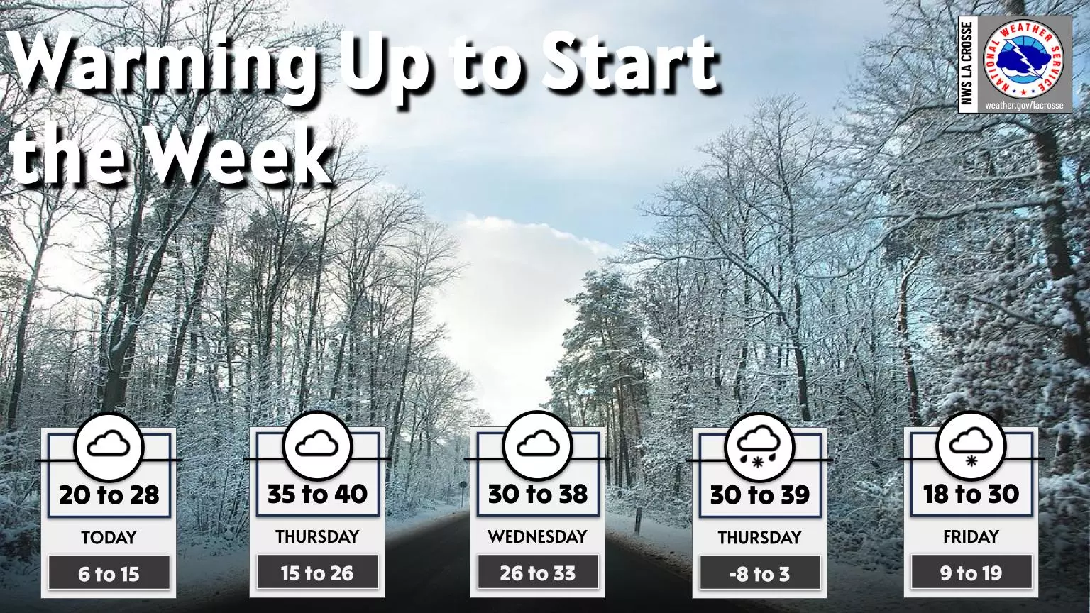
NWS La Crosse says highs will climb into the 30s and even the upper 30s in parts of the region midweek. It’s not spring, but after days where stepping outside felt like a personal attack, this will be a welcome change.
That said, the break from the cold comes with a small catch.
Midweek Weather Brings Rain, Snow, and Slick Road Concerns
The next chance for precipitation arrives Wednesday night into Thursday. According to the NWS, rain, snow, and a wintry mix are all on the table, depending on timing and temperatures. With daytime highs hovering above freezing but overnight lows dipping back down, slick roads could become an issue, especially during the morning and evening commute.
By Friday, colder air is expected to return, but not nearly on the same level as what we just went through.
11 Minnesota Winter Laws and Rules to Remember to Avoid Costly Fines
Gallery Credit: Minnesota Now
More From 106.9 KROC-FM